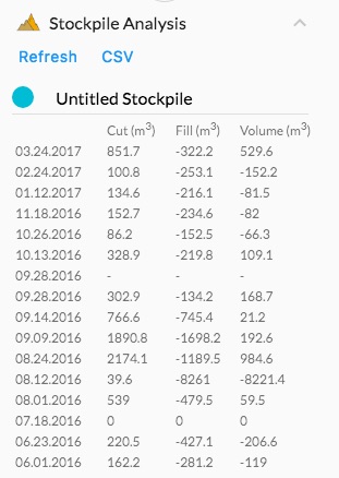
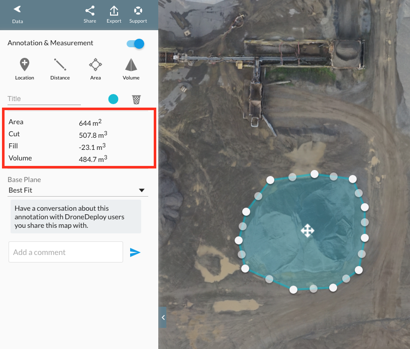
Accurately measuring stockpile volumes historically has been a complicated, time consuming, costly and labor-intensive process oftentimes subject to significant variances and unreliable accuracy.


Processing data using photogrammetry and computing stockpile volumes is quick, safe and significantly less expensive than traditional survey and measurement methods.
Accurate
Equal to or better than LiDAR survey methods
Affordable
Considerably lower cost than traditional survey methods
Fast
Reports provided within 24 – 48 hours of inspection
Safe
Eliminates the need to climb on stockpiles – significantly improves employee safety, MSHA compliance and reduces site insurance costs
Improve Decision Making and Planning
Having confidence in the accuracy of your volumetric data allows you to plan smarter and make better decisions with fewer end of year accounting adjustments.
Quick Data Collection
Save significant time and labor – collect an entire site’s data in hours not days.
Frequency
Measure Daily, Monthly, Quarterly and/or Annually
Improve Operating Efficiency and Profitability
Lower internal labor costs and increase inventory knowledge in order to reduce costly stock outs. Utilize your company personnel for their highest and best use which often is not volumetric measurements.
Eliminate Inventory Adjustments and Write-offs
Frequent and Accurate Stockpile Measurements eliminates surprise adjustments
Reduce Capital Expenditures
Eliminate the need to purchase expensive survey measuring equipment
Improve Reporting to Banks and others
Accurate, documented material inventory readily available to support financing
Streamline Inventory Material Audits
Readily available, documented, independent third party inspection with audit history of all material inventories
As a full service solutions provider serving customers throughout the United States, SKYFLEX provides market leading expertise and a turnkey solution for Stockpile Measurement and 3D Topographic Mapping for the companies in the Aggregates, Mining, Construction and Solid Waste industries. Our highly skilled, FAA certified pilots and commercial drones or UAVs provide cutting-edge precision while reducing time, equipment, and personnel.
For more information on SKYFLEX Technologies’ volumetric measurement and reporting capabilities click to see detailed questions and answers in our FAQs.